Pine Creek, hydrologically similar to Rock Creek,
is a small, volatile stream in south-central Washington state. The basin area is approximately 63 sq. mi. 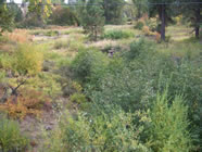 Pine Creek begins in forested headwaters at approx. 4000' in the Simcoe Mountains. For much of its downstream reach, Pine Creek exists as a subsurface channel flowing under an alluvial deposition zone from June through November.
 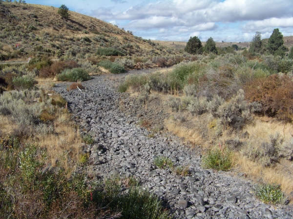 During dry summer months, surface water flows in Pine Creek, like Rock Creek, typically recede and become intermittent, going subsurface for extended reaches, where there are periods of zero flow between water years. Flow throughout the year averages 11.5 - 23.5 cfs (Nov.-Apr.). Average subbasin elevation is 1904 feet; average annual precipitation is 10.8 inches.
Spawning and rearing habitat for steelhead exists in Pine and Juniper Canyon creeks, and YN biologists have seen live steelhead and redds up to RM 3.5, and O. mykiss fry to headwaters. According to reports, tribal dipnetting occurred at a tributary confluence with Juniper Canyon in the past (Sam Jim).
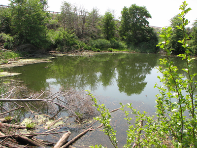 At its confluence with the Columbia River, Pine Cr. expands into a small riparian pool. A system of five culverts passes flow under SR 14 and the Burlington Northern Santa Fe railroad to Lake Umatilla. The intended entrance is fully submerged at approximately 30' depth in Lake Umatilla. The upstream invert of the pipes is several feet above the pool water surface much of the year. A large volume of sediment and debris has filled in the previous creek channel nearly 15 feet, and obstructs the entrance to the submerged culvert.
 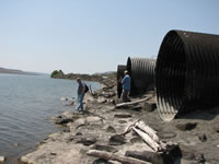 Only a small opening clogged with woody debris passes flow from the stream through the road fill. The constricted culvert entrance has created a barrier to fish passage due to physical obstructions and high water velocities (Harbor Consulting Engineers 2007). These submerged culverts preclude access to potential steelhead habitat, and are considered 0% passable and a high priority by Washington Dept. of Transportation (WDOT), and are scheduled to be repaired or replaced in 2012. Repairing the barrier to fish passage would allow an estimated potential gain of 490,830 m² of rearing area.
Harbor Consulting Engineers completed a preliminary engineering design evaluation of current impediments to fish passage at the Washington State Route 14 and Burlington Northern Santa Fe (BNSF) crossings at Pine Creek, and developed conceptual alternatives for restoring access to existing native fish habitat upstream. (Harbor Consulting Engineers 2007). While no confirmed impassable natural barriers to fish have been identified above the confluence with Lake Umatilla, various flow barriers exist.
Pine Creek boasts excellent water quality, but exceeds Dept. of Ecology standards for temperature.
YN Fisheries has a weather station in middle Pine Creek, monitored by a TFW Fisheries biologist. Assessment of fish habitat and conditions in Pine Creek is ongoing.
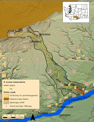
Pine Creek subbasin major streams and steelhead distribution (YN Fisheries 2007)
Pine Creek Fish Passage Conceptual Engineering Design Report (Harbor Consulting Engineers, 2007)
WDFW Response Letter to Harbor Engineering Design Report (WDFW, 2008)
Southern Ceded Lands