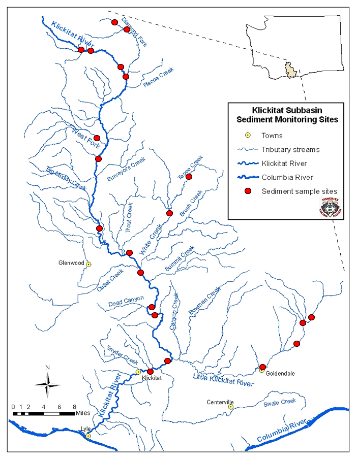
To view a sediment report for a specific location, select from the drop-down menu options here Diamond Fork Upper Meadows Sed Rpt Diamond Fork Upper Meadows Sed Rpt Diamond Fork Bottom of Meadows Sed Rpt Diamond Fork Mouth Sed Rpt Klickitat River Near Elk Horn Creek Sed Rpt Klickitat River in McCormick Meadows Sed Rpt Klickitat River near Cow Camp Sed Rpt Lower West Fork Klickitat River near 255 Rd SedRpt Klickitat River near Signal Peak Bridge Sed Rpt Klickitat River near Parrotts Crossing Sed Rpt Klickitat River near Hatchery Sed Rpt White Creek meadow belowTepee Cr. confluence Tepee Creek below IXL Road Sed Rpt Klickitat River downstream of White Cr. Sed Rpt Klickitat River near Leidl Bridge Sed Rpt Klickitat River near Stinson Flats Boat Ramp Sed Rpt E. Prong Little Klickitat R. at Box Cyn. Rd. Sed Rpt Little Klickitat River near 3 Crks Lodge Sed Rpt Little Klick River near Goldendale City Park SedRpt Klickitat River near Hwy. 142 below L. Klickitat R. Sed Rpt Klickitat River below Swale Creek Sed Rpt
or click on a red dot on the interactive monitoring sites map:
Klickitat Subbasin Sediment Monitoring Sites